
Total control of your fleet
PetroTruck manages tankers, tractor units, delivery vehicles, light vehicles and machinery. In a single platform, it answers where each unit is, how it is being used and what it costs to keep it running.
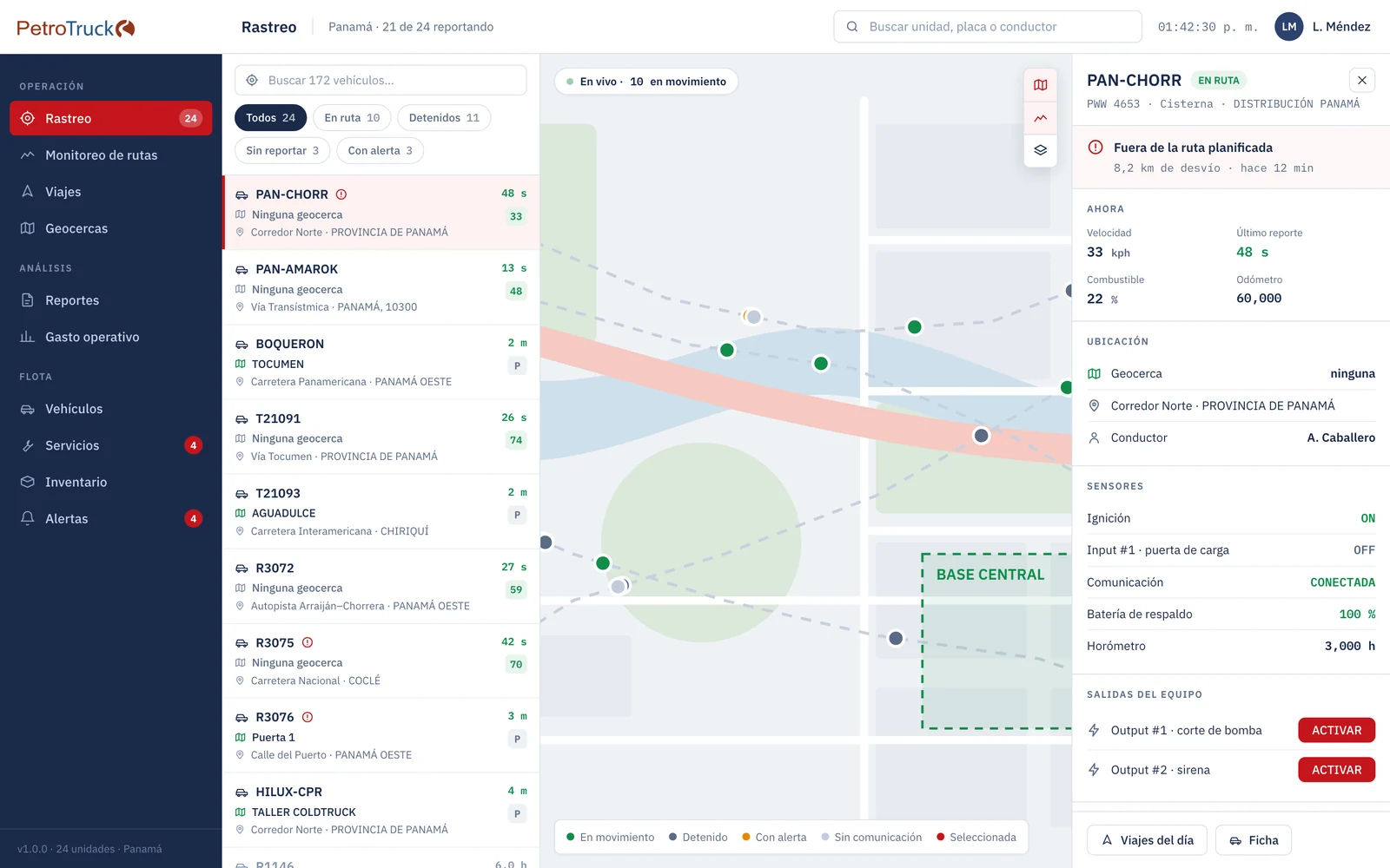
Tracking on the web platform. Sample data.
Live tracking, geofences, the day's trips and routes with deviation alerts.
Engine computer (ECU), driving, idling and alerts handled on the spot.
Fuel, maintenance, inventory and cost per kilometer.
From the vehicle to management
The onboard device reports position and reads the engine computer (ECU). That data stream produces trips, geofence events, counters and cost per kilometer.
The web platform
The screen that stays open all day: unit list, map with the track and fleet status, with ten modules ranging from tracking to cost per kilometer. It works with the PTT-1 Tracker and also with devices from other brands: switching device suppliers does not change the system.
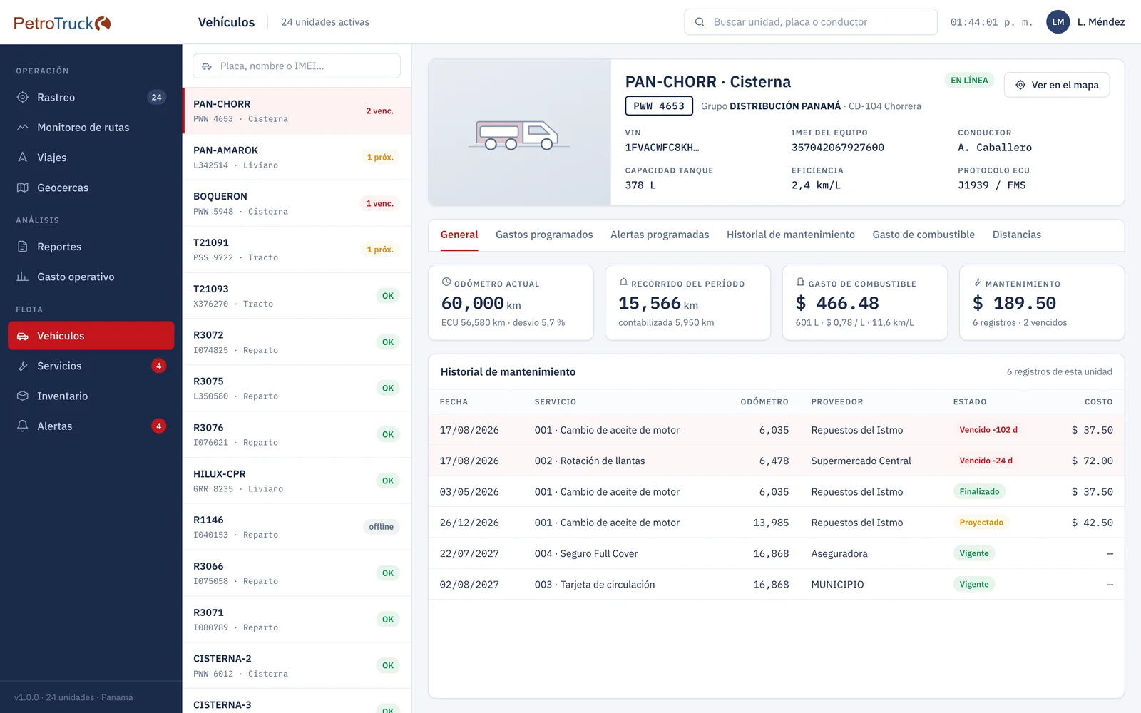
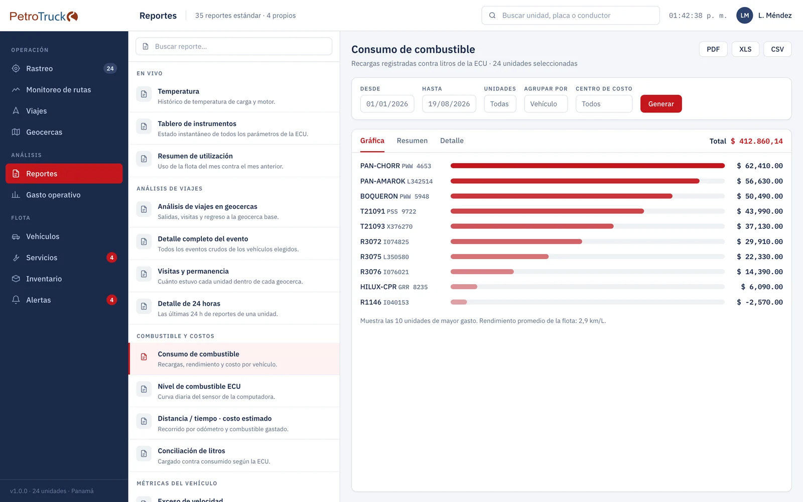
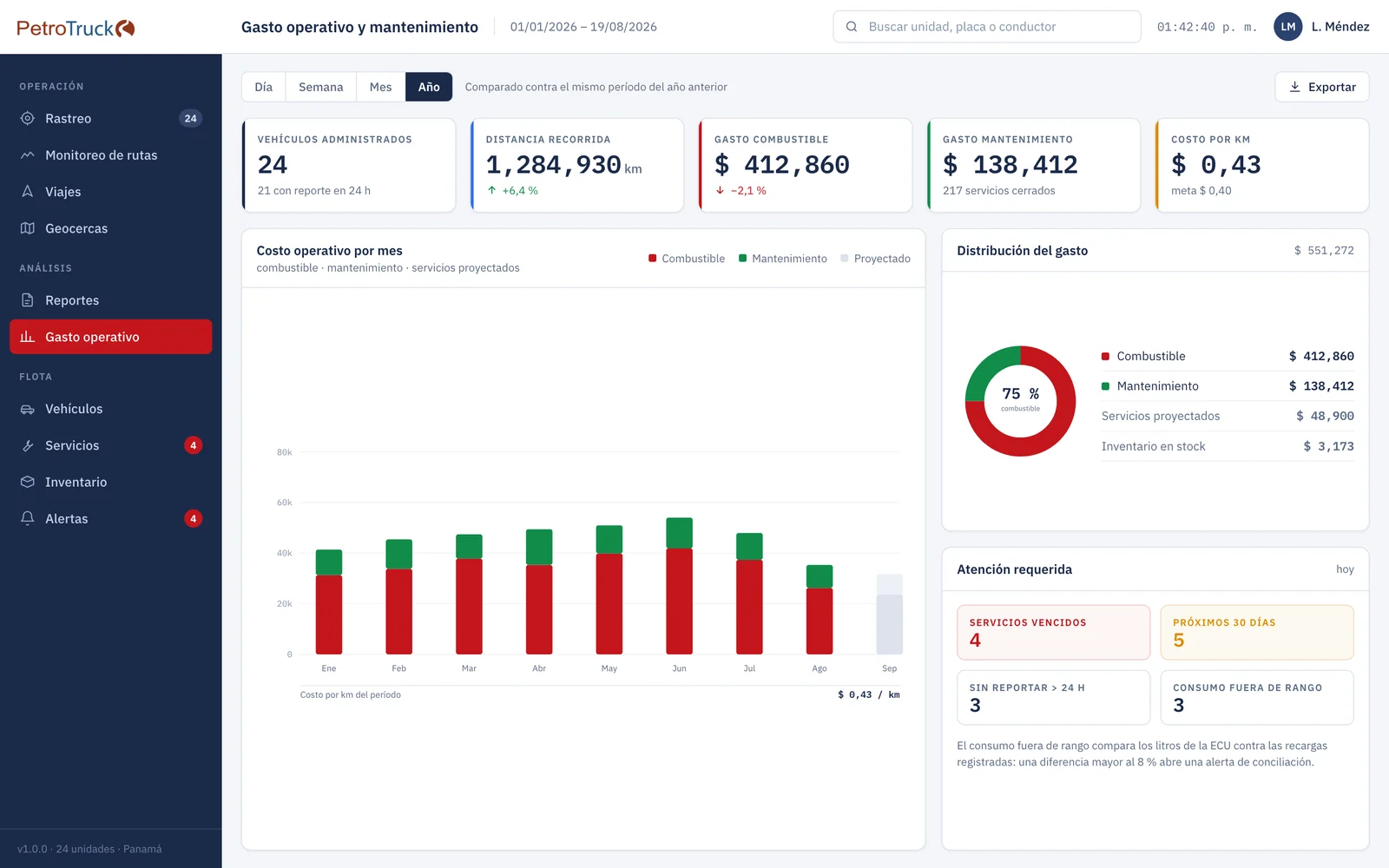
Tracking
Unit list with geofence, address and age of the last report; map with the track of the selected unit. Filters: en route, stopped, not reporting and with alert.
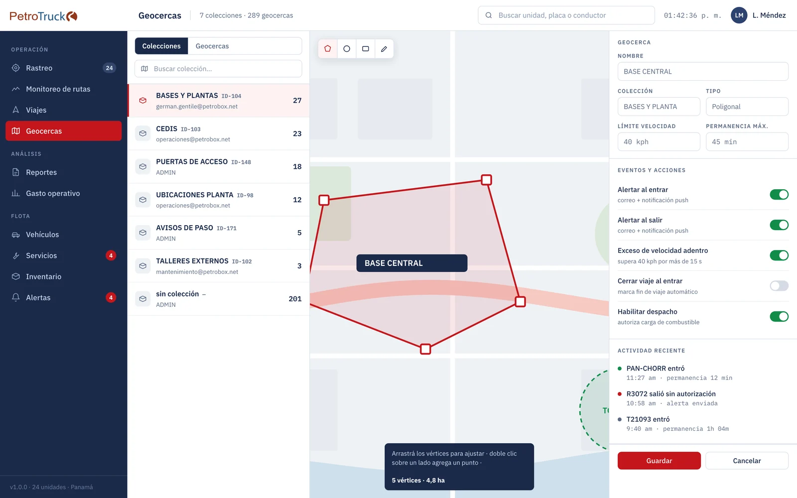
Geofences
Circular or polygonal zones with speed limits and maximum dwell time. They report entry and exit, authorized or not, and enable fueling.
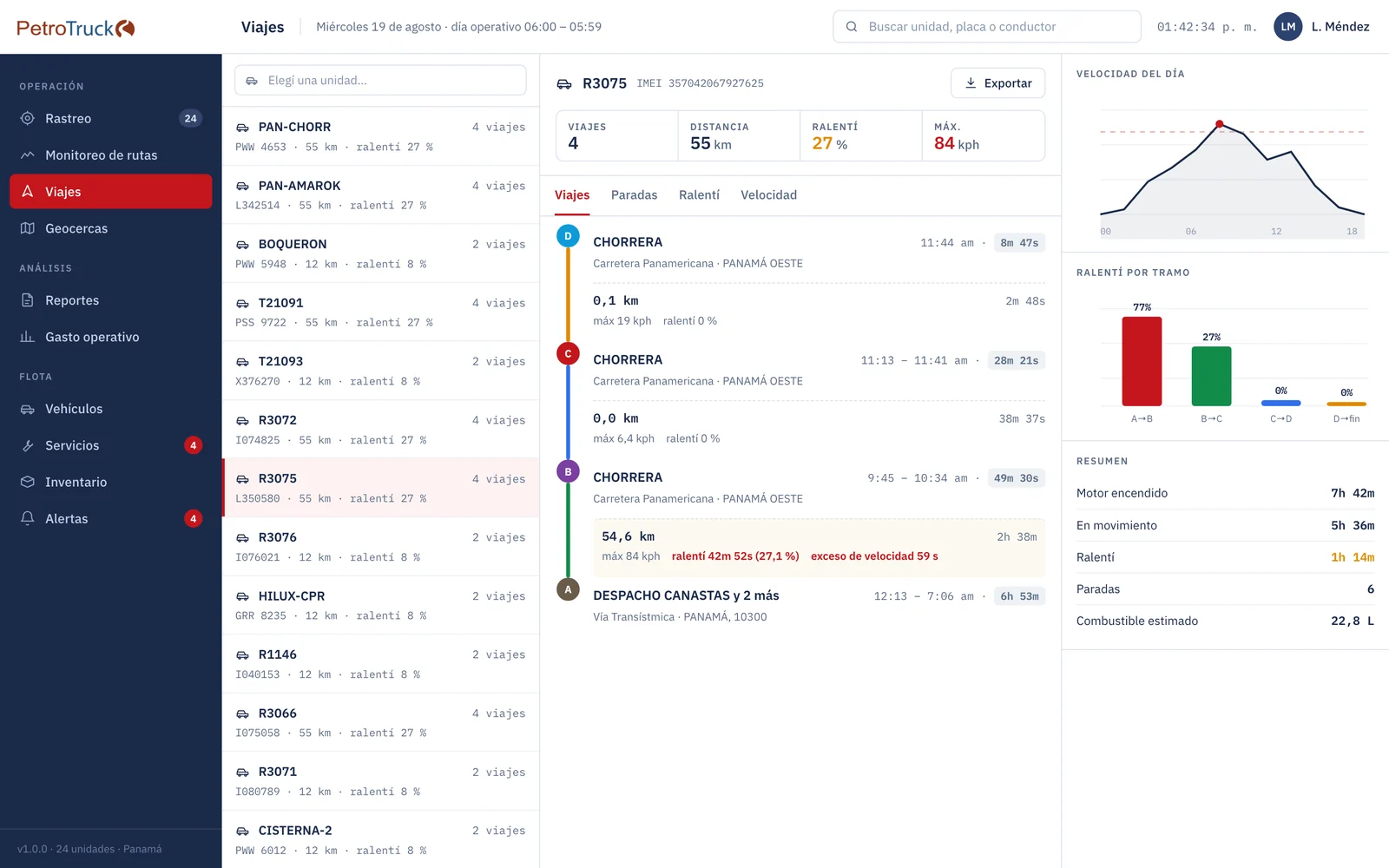
Trips
Each unit's day: stops, legs, distance, top speed and idling, with the route on the map.
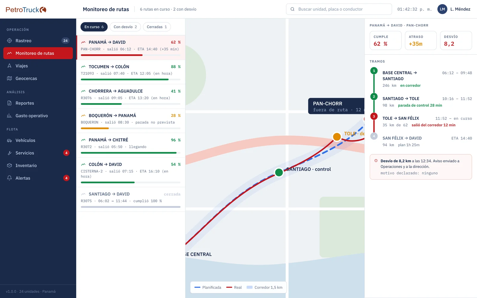
Route monitoring
Planned route with a tolerance corridor. Shows live progress and estimated time of arrival, and alerts on deviation as it happens.
Vehicles
Profile of each unit with driver, onboard device and counters: GPS and ECU odometers kept separately, hour meter and liters.
Services and inspections
Maintenance by days, kilometers or hours, due at whichever comes first, with the odometer taken from GPS.
Fuel
Fueling records, fuel economy per unit, cost per liter and per kilometer, and reconciliation of fueled liters against those reported by the ECU.
Inventory and suppliers
Spare parts and supplies with stock levels and minimums. Every withdrawal is charged to a vehicle through a work order.
Operating costs
Management dashboard: distance, fuel, maintenance and cost per kilometer, by cost center, group, branch and country.
Alerts
Speed, geofence, idling, tampering, no communication, engine fault, aggressive driving and due dates. Every alert is acknowledged: it records who saw it and what they did.
Reports are grouped into operations, driving, fuel and maintenance. All of them export to PDF, spreadsheet and CSV, and can be scheduled by email.
The fleet on your phone
Each unit's status, the map, the day's trips, engine data and alerts to act on right away.
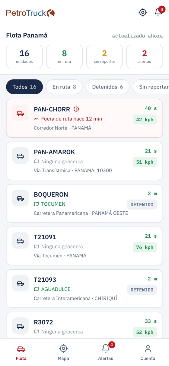
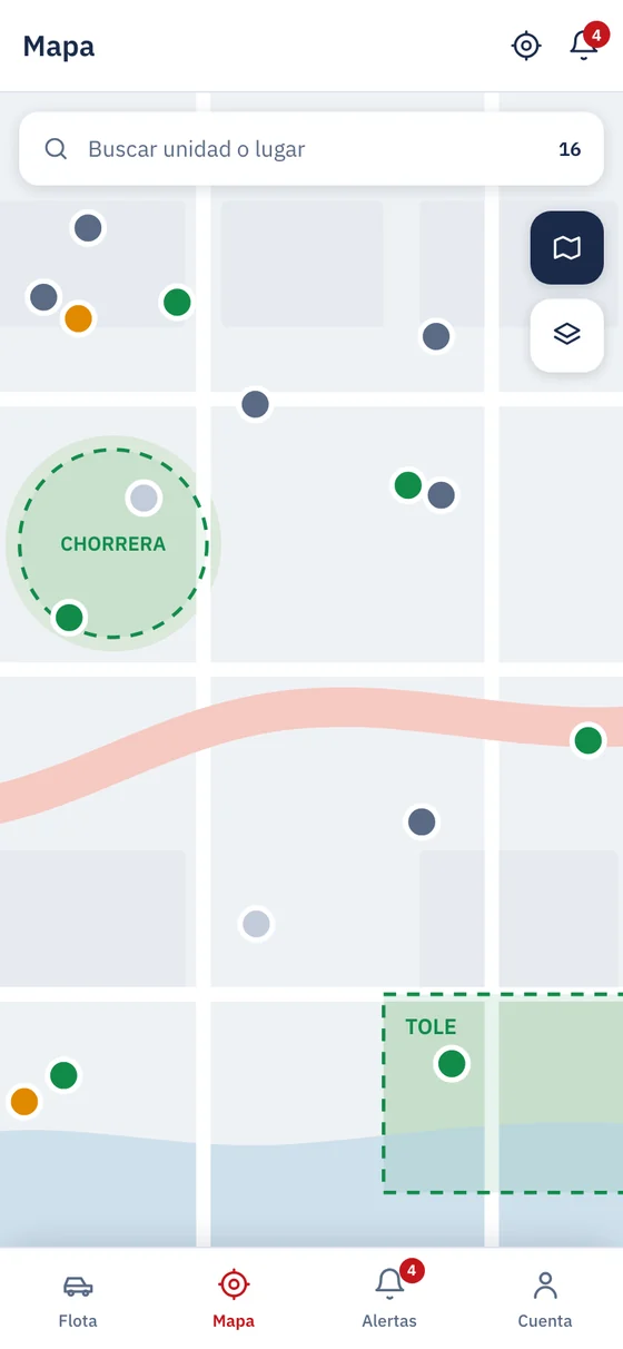
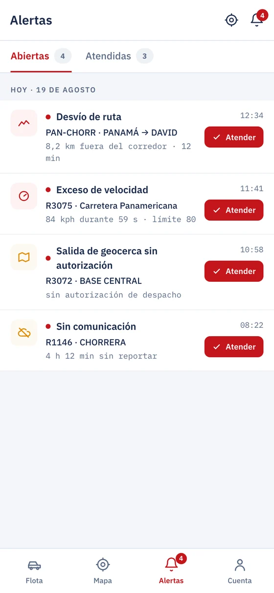
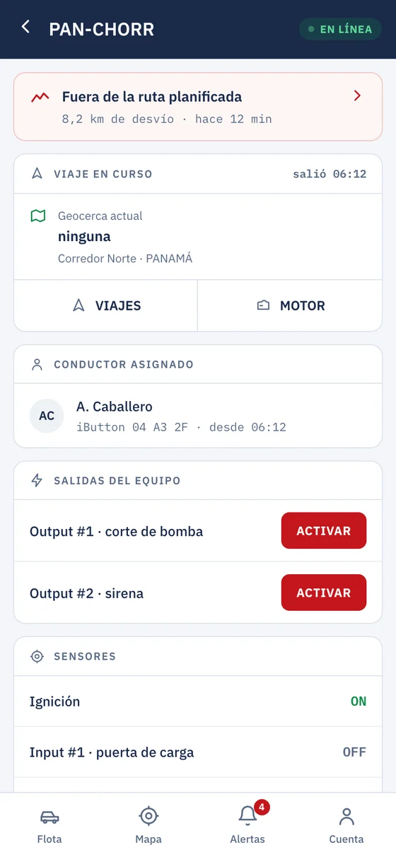
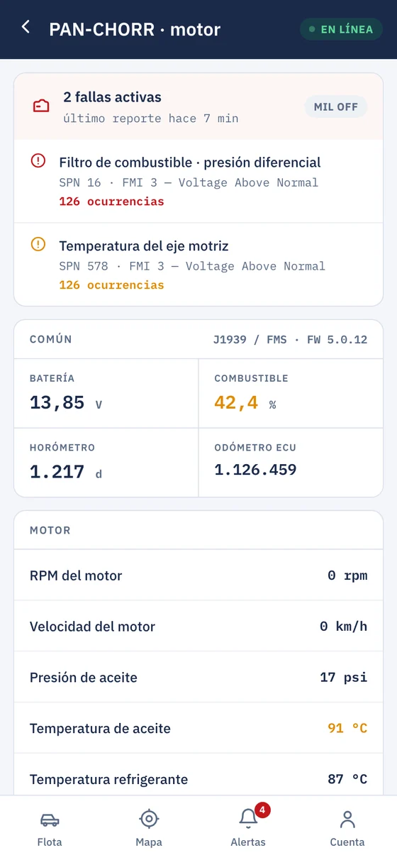
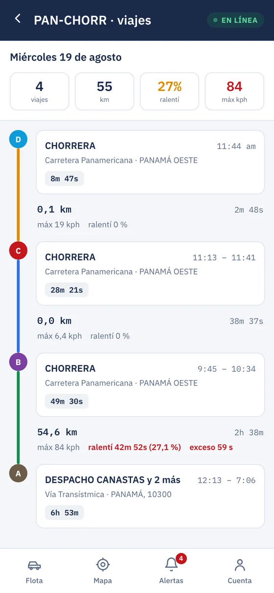
Screens with sample data.
PetroTruck Tracker PTT-1
Bolts into the cab and connects to the vehicle with a single cable. It reads the engine, knows where it is and sends it all to the platform over the cellular network.
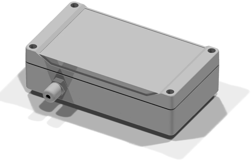
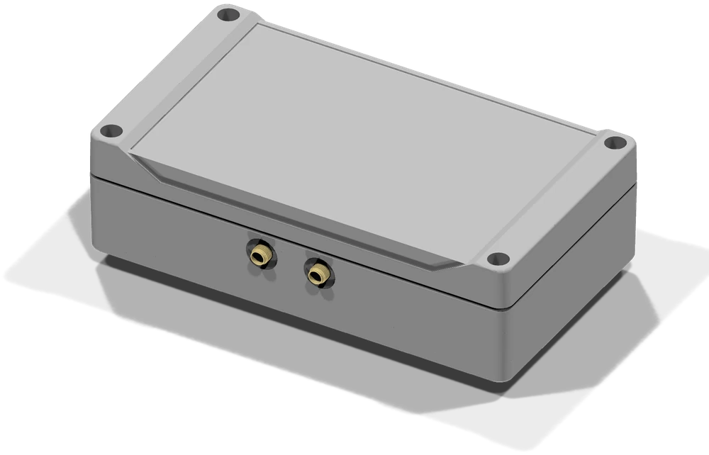
- Reads the engine: mileage, engine hours, liters consumed, tank level and fault codes published by the ECU.
- Knows where it is: dual-frequency GNSS receiver, which improves positioning among buildings and under trees.
- Sends it: over the LTE cellular network with 2G fallback. With no signal, it stores the data and sends it when coverage returns.
| Position | GNSS L1 + L5 with GPS, GLONASS, Galileo, BeiDou and QZSS. Active external antenna. |
|---|---|
| Communication | LTE Cat 1 bis modem (bands B2, B3, B4, B5, B7, B8, B28 and B66) with GSM 850/900/1800/1900 fallback. Nano SIM. |
| Engine | OBD-II and J1939 over CAN, and K-line (ISO 9141 / KWP2000) on older vehicles. |
| Engine data | Mileage, engine hours, liters consumed (J1939), tank level and fault codes. |
| Events | Ignition, fueling, possible fuel theft and mismatch between ECU-reported speed and GPS speed. |
| Logging | One sample per second, stored in memory. With no signal, it sends them once coverage returns. |
| Power supply | 12 or 24 V from the vehicle, with fuse, protection diode and surge suppressor. |
| Antennas | Two SMA connectors: GNSS and LTE. |
| Enclosure | Polycarbonate, IP66. |
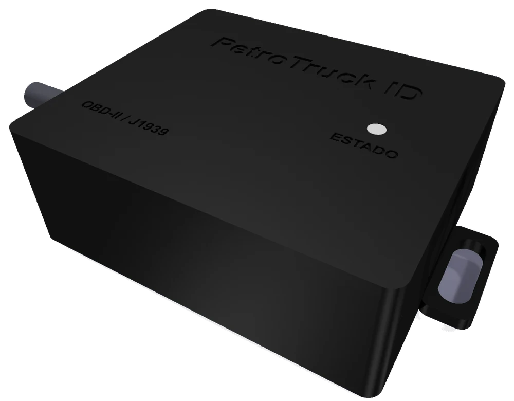
PetroTruck ID
Reads mileage and consumption data straight from the vehicle's computer. On arriving at the fuel island, it sends them via Bluetooth to the dispenser system: the vehicle is identified and the odometer is entered without typing.
- Connects to the diagnostic port: OBD-II or J1939, with a 16-pin OBD or 9-pin Deutsch cable.
- Also reads the chassis number (VIN).
- Works with 12 or 24 V.
- Sealed 65 × 55 × 24 mm enclosure, with status LED.
Integration with the stations
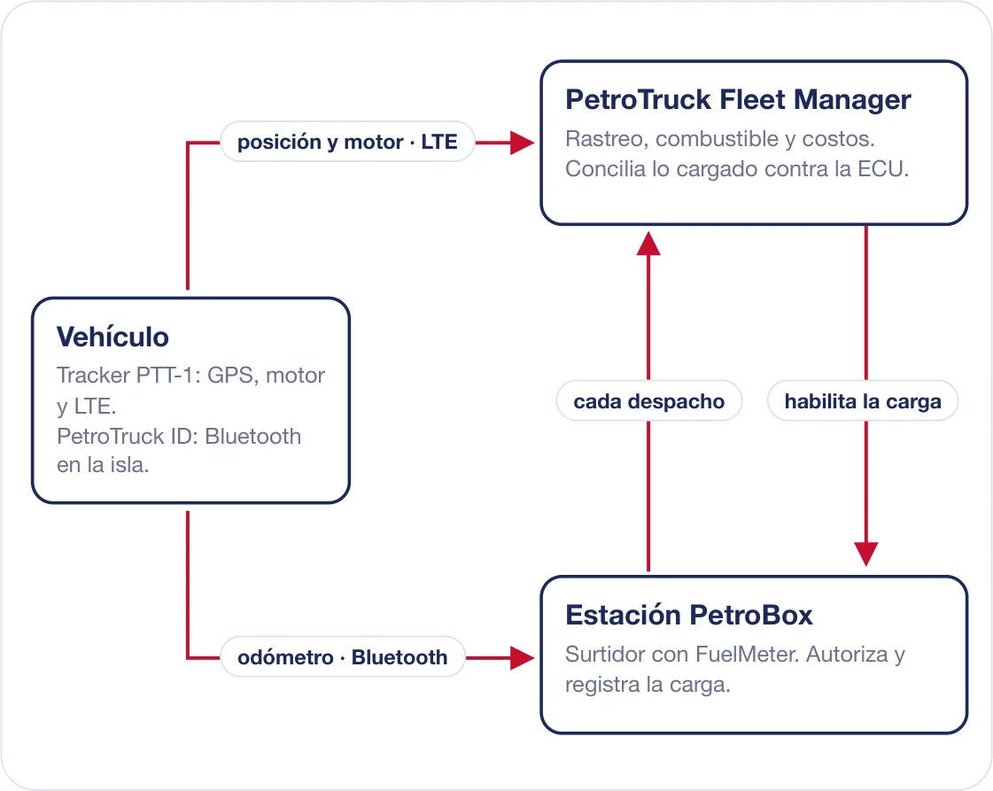
PetroTruck and PetroBox share fuel information: the unit fuels only where it is authorized to, every fueling enters the platform automatically, and the fuel loaded is compared with what the engine consumed.
- Geofence-enabled fueling: the unit can fuel only inside an authorized geofence.
- Automatic fueling records: every fueling at the station enters the platform with liters and price, with no manual entry.
- Reconciliation: fueled liters are compared with those reported by the engine computer (ECU). A difference greater than 8 % opens an alert.
- PetroTruck ID at the fuel island: identifies the unit and enters the odometer without typing.
What is normal for each fleet
Thresholds are set by fleet, group, geofence or route. These are the starting values.
| Parameter | What it is | Default |
|---|---|---|
| Minimum stop: | How long the unit must stand still to count as a stop. | 5 min |
| No communication: | How long a unit can go without reporting before it is flagged as lost. | 30 min |
| Speeding: | Threshold and minimum duration for it to count. | 80 km/h · 15 s |
| Prolonged idling: | Time stopped with the engine running that triggers the warning. | 20 min |
| Tolerance corridor: | Width around the planned route. | 1.5 km |
| Deviation alert: | Time outside the corridor before alerting. | 12 min |
| Service advance notice: | How far in advance an upcoming service is flagged. | 30 days · 1,000 km |
| Fuel reconciliation: | Gap between fuel loaded and fuel consumed that opens an alert. | 8 % |
| Operating day start: | Time at which the day starts for reports and trips. | 06:00 |
| Position retention: | How long it remains available online. | 24 months |
What each unit needs
| Data SIM | Nano SIM with a data plan, from a carrier with LTE on the device's bands or with 2G. |
|---|---|
| APN | The SIM carrier's APN. |
| GNSS antenna | Active, L1 + L5, powered at 3.3 V, with male SMA connector. |
| LTE antenna | Covering the carrier's bands, with male SMA connector. |
| Power supply | 12 or 24 V from the vehicle, through the device cable. |
| Engine connection | OBD-II, J1939 or K-line, depending on the vehicle. |
Try PetroTruck
Two demos with sample data, no sign-up required.
Already a customer? Sign in ↗ · Brochure to share: petroboxinc.com/comercial/petrotruck
Let's talk about your fleet
Tell us how many vehicles you have and what you want to control, and we will put together a proposal for you.
Message us on WhatsApp